Chesapeake Bay Magazine,
EZ-Pass for Fish: High-Tech Tracking Sees Early Success
A clever piece of technology is allowing scientists to tag fish and then
study their movements up and down the Bay. And after just one season in use,
they already have useful data on more than 3,800 individual fish.
It’s
called acoustic telemetry. The technology is similar to electronic toll
collection systems for cars and trucks. Receivers anchored in the Bay’s bottom
(toll plazas, if you will) can “hear” a tagged fish from up to a kilometer
away. A small computer in the receiver logs information about when it “heard”
the fish. NOAA has installed more than two dozen of these receivers up and
down the Bay.
“Telemetry allows fish to tell their own stories,”
said Dr. David Secor. A professor at the
University of Maryland Center for Environmental Science
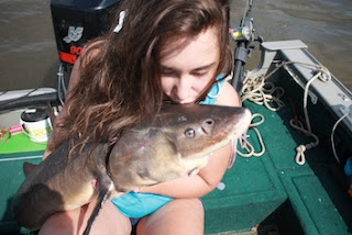
(UMCES), he studies endangered Atlantic sturgeon, especially the ways in which
they travel to Delmarva’s Nanticoke River/Marshyhope Creek system, the only
Maryland waterway in which we know they spawn.
Dr. Secor and other scientists
periodically download the receiver’s accumulated data. “Knowing Chesapeake
mainstem corridors for migrations by this endangered species could inform
issues pertaining to influence of climate on spawning run behaviors, vessel
strike threats, and assessment of spawning run sizes in recovery plans for the
species,” he notes.
Dr. Matt Balazik
of Virginia Commonwealth University (VCU) also uses the technology to track
sturgeon from Virginia’s three known spawning rivers (the James, Pamunkey, and
Rappahannock).
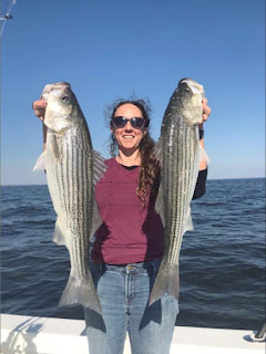
Dr. Secor studies rockfish (striped bass) too. Here
telemetry helps strengthen the overall database the
Atlantic States Marine Fisheries Commission
(ASMFC) uses to help restore this immensely valuable but currently depleted
species. In addition, Dr. Secor explains, “Telemetry of migratory fishes
moving through offshore wind lease areas will inform managers on risks of
turbine construction impacts.”
The Chesapeake holds several sets
of telemetry receivers. A Northern Array includes four receivers anchored near
the Chesapeake Bay Bridge by Annapolis. It’s funded by the
Chesapeake Bay Office of the National Oceanic and Atmospheric
Administration
(NOAA NCBO), in partnership with the Maryland
Department of Natural Resources (MD
DNR). A Mid-Bay Array includes six receivers near the mouth of the Patuxent
River, managed by UMCES. A Southern Array sets twelve receivers across the
Bay’s mouth off Virginia Beach. NCBO funds it too, working in partnership with
the
Virginia Marine Resources Commission
(VMRC). All five buoys currently deployed in NOAA’s
Chesapeake Bay Interpretive Buoy System
(CBIBS) hold receivers in addition to their water quality sensors. Thus they
help fish researchers correlate water temperature, salinity, dissolved oxygen,
and other conditions that each tagged fish experiences near a CBIBS buoy.
Finally, UMCES has placed three receivers in the Choptank River near oyster
restoration projects. These receivers, on loan from
NOAA Fisheries’ Northeast Fisheries Science Center, will help scientists learn more about how fish use restored oyster
reefs.

No comments:
Post a Comment