Showing posts with label James Island. Show all posts

Saturday, May 23, 2026

Work on James Island Beginning

Army Corp of Engineers: Notice to Boaters: Avoid James Island Construction Zone in Dorchester County
The U.S. Army Corps of Engineers, Baltimore District, awarded a $53.83 million base contract to C&C Joint Ventures, LLC, of Gloucester, Virginia, for restoration work at James Island, part of the Mid-Chesapeake Bay Island Ecosystem Restoration project in Dorchester County, Maryland.

The contract award ushers in the first phase of Mid-Bay restoration work on James Island including mobilization, hydrographic surveys, perimeter dike construction, dredging and the creation of a sand stockpile to be used for future dike construction work.

Construction activities are expected to begin in late April 2026. Mariners are urged to use extreme caution and reduce speeds surrounding the James Island Construction Safety Zone and fully avoid the area within the zone as underwater construction activities may cause damage to vessels as well as boating and fishing equipment.

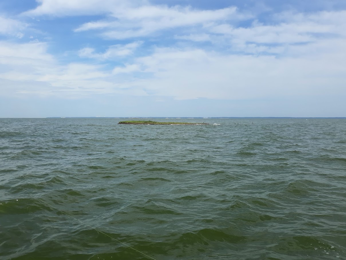
James Island was three miles long, heavily wooded, and easily visible from our beach when we arrived here in 1985. A few years ago the last trees fell, and even though a few fragments of islands still emerge above the water, it is effectively gone. The remnants have provided Pete some good fishing in recent years. I'm sure he will miss those as the work is being carried out.

They are still continuing work on Barren Island, a few miles to the south: 

The U.S. Army Corps of Engineers (USACE), Baltimore District, is urging boaters in the Chesapeake Bay to steer clear of ongoing construction activities near the Mid-Bay Island Project, located adjacent to the islands of James and Barren in western Dorchester County.

Barren Island phase 2 construction began in January 2025 and is expected to last approximately three years.

Please avoid accessing the water surrounding Barren Island, shown in the Safety Announcement. Water users entering the area noted below do so at their own risk. Underwater construction activities in this area may cause damage to equipment and vessels.

Please use extreme caution, reduce speeds, and avoid entering the Barren Island Construction Safety Zone. There will be multiple vessels anchoring at the Barge Moorings and moving between the navigation channel and Barren Island. Sand and sediment required for construction will be dredged from Borrow Area B (sand) and the Honga River navigation channel (sediment) and transported or piped to Barren Island. Through 2027, expect to see increased barge and vessel activity as well as marked material pipes throughout the water north, west, and south of the island. For reference, the Barge Mooring locations and Borrow Area B are approximately 1.2 Nautical miles west of Barren Island.

Barren Island project components that will be constructed during phase 2 include:
  • Building two islands along the southern breakwater that will create bird habitat.
  • Building structures inside the southern sill for dredged material containment.
  • Creation of the southern spillway, which controls water release during and after dredged material placement.
  • Replacing the existing northeast sill foundation with stronger foundation material and installing the remaining northeast stone sill.
  • Dredging in the Honga River Channel and placement of dredged material in the southwestern wetland for habitat restoration.
The construction is part of Baltimore District's Mid-Bay Island Ecosystem Restoration Project, which is in partnership with the Maryland Port Administration to restore 2,072 acres of lost remote island habitat on James Island and 72 acres of remote island habitat on Barren Island, using material dredged from the Port of Baltimore approach channels and the Honga River, respectively.

Remember, the primary driver for this work is to provide a place to dump dredge spoils from Baltimore Harbor. Rebuilding the islands is just a side benefit. 

Monday, January 27, 2025

Feds, State Set Eye on James Island

An old picture of James Island
 Bay Journal, Feds, state close in on building new island in Bay

James Island is gone. Long live James Island.

I beg to differ, it is not gone yet, at least as of late fall when we visited the island in search of fish. Admittedly, only three or four small nubs of the original three mile long island are still above water. As you may know, James Island is located directly across the Chesapeake Bay from our beach, and we have been witnesses to its diminishment. 

The U.S. Army Corps of Engineers and Maryland Port Administration are finalizing their proposal to resurrect an island that has vanished beneath the waves of the Chesapeake Bay. If all goes according to plan, James Island will convert more than 2,000 acres of open water into prime habitat for migratory birds while helping to protect communities on the vulnerable Eastern Shore from further erosion.

At the same time, it will solve an unending problem for the Port of Baltimore: finding a placement site for the built-up sediment dredged annually from the Bay’s shipping channels.

One of the remaining fragments of James Island
July 2024
 

With the November release of the project’s final Environmental Impact Statement (EIS), the two agencies took a critical step toward beginning construction on what is poised to become the largest human-made island in the Bay. The island is set to rise north of Dorchester County’s Taylors Island just outside the mouth of the Little Choptank River. It will be built using the mucky sediment cleared from shipping channels.

The report presents the most detailed look yet at how the massive undertaking will take place.

Several state and federal agencies, along with members of the public, submitted written comments to which the Army Corps was required to reply. Here’s a summary of key topics.

Where is the dredged sediment coming from?

That would be the approach channels in the Upper Bay that lead to the Port of Baltimore and the Chesapeake and Delaware Canal, which bisects the northern Delmarva Peninsula. For nearly 30 years, that material has been used to rebuild Poplar Island just offshore from Tilghman Island on Maryland’s Eastern Shore.

Will that muck be contaminated?

That’s a big concern shared by many in the fishing community. “You don’t know how toxic it is even though they’re supposed to test it,” said Bob Whaples, a longtime waterman, in an interview.

The Army Corps said in the EIS that “existing data do not support [such] claims.” The sediment is routinely sampled, and the results are sent to the Maryland Department of the Environment. If the material isn’t safe enough, it won’t be placed on the island, the Corps said.

A legacy of shore-hardening and industrial pollution has led to widespread contamination of Baltimore Harbor. But James Island, like Poplar, would source its material from the Upper Bay, which derives cleaner silt from the Susquehanna River flows and shoreline erosion, the Army Corps wrote.

Why is this happening now?

Poplar is set to reach its 1,715-acre capacity around 2030. Each year, dredges scoop up around 3 million cubic yards of silt from the bottom of the channels to keep them open for huge container ships. The state of Maryland bans the placement of dredge material into open water. So, officials are on the clock to prep Poplar’s replacement. Construction on James is targeted to begin by the end of 2025.

How will the new James Island be protected from erosion and sea level rise?

Like Poplar, much of James will be ringed by a formidable stone dike, measuring 20 feet high above the low-water line and about 9 miles in circumference. Holding cells must be finished before the dredge material is brought in. That’s because the fine-grained silt is mixed with water before being transported by pipe and would wash away into the surrounding Bay without containment.

Bay islands are typically bounded by sand or marshes. Isn’t all that stone unnatural?

Yes, which is why the Army Corps is mulling a slight alteration to the approach it used for Poplar.

The stone barrier there has helped attract fish around the outside of the island, delighting local anglers. But few larger specimens are brave enough to make their way inside the island’s perimeter using the long culverts that serve as outfalls for the internal creeks, said Jonathan Watson, a fish biologist for the National Oceanic and Atmospheric Administration (NOAA). “It’s kind of a scary place for fish to venture into,” he said.

Watson and his colleagues recommended constructing wider, deeper inlets and connecting them with habitats that fish love, such as wetlands and offshore rock reefs. The Army Corps indicated it will adopt these practices years down the road after the material settles into place.

“We want to build off what we did on Poplar, but make it Poplar 2.0,” said Angie Sowers, an Army Corps planner.

The James marshes are being designed to support living things. Which ones?

The EIS comments show agencies at odds over which species should benefit most from the effort. The answer to that dilemma has big implications for how the island is built.

Slightly over half of the island’s acreage is set to become wetlands. Transforming most of that acreage into “high marsh” habitat, as advocated by the U.S. Fish and Wildlife Service, would give the island more protection from sea level rise and make it more hospitable to rare bird species. Favoring a lower footing, as promoted by NOAA scientists, would be more conducive to aquatic species.

In the final EIS document, the Army Corps proposes a 50–50 split between high and low marshes. At Poplar, the low marsh acreage prevails by a 4-to-1 ratio over high marsh.

“This entire project is a balancing act of providing benefits to all the species that use this habitat,” Sowers said.

Couldn’t some of the silt help shore up low places elsewhere?

Much of coastal Dorchester County is in danger of being swallowed up by sea level rise. Officials with NOAA and the Maryland Department of Natural Resources pushed the Army Corps to divert some of the material bound for James toward restoring wetlands on the county’s mainland.

They are also currently restoring Barren Island, a similarly declining island a few miles south of James Island. I imagine they will conclude their work there before moving onto James. Or perhaps they'll finish outlining the perimeter of Barren Island with rock and move onto James while the interior of Barren is being built up with dredge spoils. That's how I would do it, if I had the resources. 

Bear in mind, island restoration is just a happy secondary goal in this work, the real point is to provide a place to dump dredge spoils from the shipping lanes in Baltimore Harbor and upper Bay. 

Thursday, November 30, 2023

Chesapeake Bay's Growing Islands

Chesapeake Bay Mag, 
Ariel view of Barren Island
The Bay’s Reappearing Islands

In September 2022, a $43.1 million contract was awarded to the U.S. Army Corps of Engineers for the restoration. The funds, made possible by the Bipartisan Infrastructure Law, will restore up to 2,072 acres on James Island and 72 acres on Barren Island. The projects should be completed by 2067 at an estimated total cost of $4 billion.

“We are very happy to be working on this exciting project with our great partners at the Army Corps of Engineers,” says Richard Scher of the Maryland Port Administration – Port of Baltimore. “Rebuilding James and Barren Islands is an environmental and commerce win-win.”
James Island in 1999
Situated along Maryland’s Eastern Shore near Upper Hooper Island, Barren Island was popular farming and hunting grounds until around the early 1900s when significant erosion began. By 1916, most families had left, but hunting remained popular. Eventually, humans left the island for good, and in the early 2000s a hunting lodge, one of the last remaining structures, was swept away. The island has lost 42 acres over the past two decades alone.

James Island in 2022
 

James Island, a short boat ride north of Barren Island toward Little Choptank River, was once a vast 1,300 acres in the mid-1800s. The islands share a similar story. By 1910, most families (primarily farmers) were gone, but it wasn’t completely abandoned. In 1916, local Clement Henry released imported Sika deer on the island in an attempt to make the spot a hunting destination. While his wish did come true, nature slowly reclaimed James Island until it was only 550 acres by the 1990s and eventually deserted. Stone sills and breakwaters are currently being built around Barren Island. The structures help protect the restoration area from strong waves and wind. Photo courtesy of U.S. Army Corps of Engineers

While the Bay has slowly devoured these islands, engineers are planning to use dredged material to reverse the process. Dredging is a common practice around the Bay, where silt washed from the shores by wind and wave action tends to fill up the channels. This is especially true in Baltimore Harbor, where channel depths and widths need to be maintained for safe ship navigation.

“Dredging will keep happening because channels need to keep being dug,” says Jackie Specht, The Nature Conservancy’s Resilient Coasts Program Director for Washington, D.C. and Maryland. “Rather than just putting the material in storage on land it’s used instead to create habitats and marshes across the Bay.”

The USACE dredges around five million cubic yards each year from these channels and anchorages—material that needs to be disposed of in an eco-friendly way. “This project implements a long-term strategy for providing viable placement alternatives to meet the dredging needs of the Port of Baltimore while maximizing the use of dredged materials as a beneficial resource,” says Mitchell.
. . .
 Barren Island is the project’s current focus and will be restored to its original footprint. Once completed, up to 83 acres of wetlands and 1,325 acres of nearby seagrass beds will be established. The island’s first reconstruction phase began earlier this year and involves installing breakwaters and stone sills to contain the dredged material. The process is estimated to last until October 2024. Depending on how things go, dredged material might also start being added next year. One of the biggest hurdles will be safely transporting equipment and supplies to the land. “It’s a complex process due to the remote nature of the project and poses an added challenge,” Mitchell says. 

James Island won’t receive attention until 2030 and will undergo a much more extensive rebuild. Once complete, the island will be 2,100 acres—800 acres bigger than its original size. It will be a mixture of upland and wetland habitats. 

Both islands are being designed with sea level rise in mind and should last for at least 50 years. 

When I visited James Island with Pete this year I was shocked at how littles was left at this point, a few small islets. But one of them held good fish. On the other hand, every time we went past Barren Island, there were work boats adding rocks to the sills and jetties, totally ruining the fishing.

I do wonder why they decided to rebuild Barren Island first. Its not as badly eroded, and it's a another few miles down Bay from the source of the fill, Baltimore Harbor. 

Tuesday, August 30, 2022

Restoration of James, Barren Island Going Forward

 Slowly. Talk of Delmarva, Restoration of Two Chesapeake Bay Islands Moves Forward

A Mid-Chesapeake Bay ecosystem restoration project will move forward, with the signing of a project partnership agreement.

The US Army Corps of Engineers and the Maryland Department of Transportation have outlined their roles, responsibilities and financial obligations regarding restoration of James Island and Barren Island in Dorchester County.

Material dredged from the Port of Baltimore approach channels and the Honga River will be put to use.

That's the first I've heard that they were going to use Honga River sediment. Is that because they have areas in the Honga that need dredging for navigation, is it used to dilute the pollution in the sediments from Baltimore Harbor, or simply because it's close? 

“It’s an honor to sign this agreement signifying ‘all systems go’ for this critically important project that will provide so many environmental benefits for Maryland,” Maryland Transportation Secretary James Ports Jr. said. “Rebuilding James and Barren islands will promote wildlife, restore coastal shorelines, and provide us with a long-term placement site for dredged material from port shipping channels, allowing us to accommodate larger ships bringing more cargo and business to Maryland.”

According to the USACE, the Mid-Bay project includes restoration of 2,072 acres of lost remote island habitat on James Island and 72 acres of remote island habitat on Barren Island. Habitat may include “submerged aquatic vegetation, mudflat, low marsh, high marsh, islands, ponds, channels, and upland areas.”

“With this project, we hope to build upon the success of Poplar Island,” USACE Baltimore District Commander Col. Estee Pinchasin said. “The habitat we restored and created using dredged material is flourishing. We are proud to partner again with the Maryland Department of Transportation’s Port Administration and employ innovative solutions that benefit the Chesapeake Bay’s ecosystem today and will do so for generations to come.”

At the link, they show the current (well, a couple years ago) island, and the proposed restoration. For James Island:

Wow! That's pretty big, and 28-30 years to complete! Next, Barren Island:

A much smaller plan. I may even see this one completed.

Wednesday, April 6, 2022

Funds for Barren, James Island Restoration Doubled

God only know how it ended up in a Texas paper, but there it is, Longview (Texas) News-Journal, Funding doubled for Mid-Bay Island Ecosystem Restoration

The state-led project utilizing dredged material to restore the habitats and structure of two Chesapeake Bay islands has secured an additional $46.5 million from the federal infrastructure bill, U.S. Senator Ben Cardin (D-Md.) announced Monday.

The money further cements the beginning of the Mid-Bay Ecosystem Restoration project, which hopes to revitalize the vanishing habitats of the James and Barren islands off the Dorchester County coastline.

Replacing Poplar Island in Talbot County as Maryland’s primary site for repurposed sediment, the Dorchester islands will be reinforced with salt and silt from shipping channels in the Bay, giving the project credence as an environmental and economic initiative.

“It’s a big deal to be able to have the continuity of a location where we can put the dredged material for keeping our harbors competitive,” Cardin told a crowd of stakeholders and media.
. . .
The cash bump unveiled Monday more than doubles the funding already allocated through the U.S. Army Corps of Engineers, which is expected to begin its first phase of construction in September. In February, $37.5 million was earmarked for Mid-Bay in the Corps’ Infrastructure Investment and Jobs Act Work Plan. Like those funds, this new money — which brings the project’s total to $85 million — will be available to the Corps for use this year.
. . .
Projected to cost $1.6 billion, according to a 2009 feasibility study, the Mid-Bay Ecosystem Restoration project aims to create 2,100 acres of new wildlife habitat between the two islands. More than half of that acreage, Pinchasin said, will become wetlands.

Beyond cultivating and protecting environments for local species, the project also seeks to protect Dorchester shorelines from erosion and storm surges.

“This has been a dream. Absolutely a dream,” Maryland Sen. Addie Eckardt, R-37-Mid-Shore, said in an interview. “It is a matter of environmental good use. It is a matter of environmental protection, dealing with the changes that we’re seeing. But then also economic because it benefits the port.”

As nice as it will be to restore these two islands, don't ever forget that the primary goal here is to have some place to put dredge spoils from Baltimore Harbor. 

Monday, January 24, 2022

James, Barren Island Restoration Going Forward

Da Balmer Sun, Chesapeake Bay island construction, key to slowing Eastern Shore erosion, gets $38M in new federal infrastructure spending

A project to rebuild two vanishing Chesapeake Bay islands — and thereby slow erosion along some of Maryland’s most vulnerable coastline — will receive $38 million under recently approved federal infrastructure spending, officials announced Thursday.

The money will go toward Army Corps of Engineers work to begin restoring Barren Island and to complete engineering fieldwork, drilling and testing on James Island. The islands off Maryland’s Eastern Shore, and others in the middle portion of the bay, have lost more than 10,000 acres of land mass since the late 1800s, according to the agency.

James Island in 2016
In the years I've lived here, James Island, which is more or less directly across the Bay from us, has dwindled from a fairly large (but very low lying) island, to a small dirt mound with a few trees. I don't even know if those made it through the winter. We sure can't see anything from the beach anymore.

The projects also are considered key to the success of the Port of Baltimore, because the islands are being reconstructed using material dredged from the bay’s shipping channels. More space for the dredged material is needed as the port upgrades and maintains berths and channels to accommodate increasingly larger cargo ships that could otherwise call on other East Coast ports.

James and Barren islands long helped protect Dorchester County shores from Chesapeake Bay winds and waves, but as they have diminished, land loss has accelerated on the mainland. In Dorchester, shorelines have receded by as much as 600 feet over the past four decades, and with much of the county at just a foot or two above sea level, more losses are expected. 
Looking across Barren Island in 2016

James Island shrunk by more than half from the mid-1800s to the 1990s, from 1,300 acres to 550, but is planned to be expanded to nearly 2,100 acres eventually. Barren Island is expected to grow to 72 acres of wetlands. Work on Barren Island is expected to start in September, while James Island construction is scheduled to begin in 2024.

The projects are expected to cost $1.7 billion over 30 years.

I look forward to fishing the rip rap walls on the restored James Island. But bare in mind, this isn't really about restoring the islands, it's finding a place to dump the dredge spoils from Baltimore Harbor. 

Saturday, August 7, 2021

MD Senate to Vote on Restoring James, Barren Islands

 BJ, Senate set to vote on funding for reconstruction of Chesapeake Bay islands

The Senate Appropriations Committee has signed off on $37.5 million in spending that could launch the reconstruction of James and Barren islands in the Chesapeake Bay.

The Aug. 4 approval sets up a vote before the full Senate. The legislation will then undergo negotiations between the House and Senate to merge their differing versions of the measure, which is part of the $53 billion Energy and Water Development Appropriations bill.

The current House bill does not include the James and Barren funding.

The $1.9 billion undertaking, called the Mid-Chesapeake Bay Island Ecosystem Restoration, will rebuild two eroding islands off the coast of Dorchester County, MD. In all, it will create more than 2,100 acres of new land.

The fill will be dredged from the shipping channels for the Port of Baltimore, keeping the lanes open for cargo traffic.

The funding would cover the first year of planned construction. Critically, the move transfers the effort off the “new start” phase, where projects can languish for years, said Sen. Ben Cardin of Maryland.

I'm looking forward to the restoration of James and Barren Islands, although I expect it to take long enough I won't see any benefit. Don't ever forget, they aren't really doing this to restore the islands, that's just a side benefit of having to find some place (other than say, the deep channel of the bay) to dump the masses of sediment, much of it contaminated, that continue to accumulate in Baltimore Harbor.

The best part of this article was the aerial picture of James Island from 1999:

James Island was still somewhat intact in this photo from 1999.

 I first stepped on James Island back in 2000, when Georgia and I and a friend took my then new boat over, anchored in the bay on the right side, and walked from end to end (it wasn't that far). That narrow strip connecting the tow main sections was still intact, but barely, maybe a foot or two wide, and marshy (it was salt marsh sod). It's long gone, as is most of what you see here now. I was by recently with Pete, and there is a small piece of the lower island left with a few trees, and a few tree stick out of the water where the upper island is. There is also a deadly (to boats) pile of downed timber underwater at the north end. Ask me how I know. 

James Island in June 2020


Friday, August 28, 2020

Corps of Engineers Seeking Advice on Barren Island Restoration

Dorchester Star: Barren Island restoration effort requests input
Planners of an effort to restore Barren Island in Dorchester County are seeking input from local residents.

The U.S. Army Corps of Engineers, Baltimore District, in partnership with the Maryland Department of Transportation Maryland Port Administration, the project’s non-federal sponsor, is preparing a supplemental environmental assessment for the Barren Island component of the Mid-Chesapeake Bay Islands Ecosystem Restoration Project. Barren Island is an element of the U.S. Fish and Wildlife Service Chesapeake Marshlands National Wildlife Refuge Complex.

The Mid-Chesapeake Bay Islands Ecosystem Restoration Project recommends remote island restoration at James Island and Barren Island, both on the Eastern Shore of Maryland and in Dorchester County, through the beneficial use of dredged material.
Looking across Barren Island to the Upper Bridge to Nowhere
As I've noted previously, they wouldn't be considering this at all if they didn't have a continuous source of dredge spoils from Baltimore Harbor.
USACE will be preparing a supplemental EA to update documentation for the National Environmental Policy Act of 1969, as amended, focused on the Barren Island component of the project. A similar action will be undertaken at a future time for the James Island component.

The authorized project consists of restoring Barren Island (72 acres), which is 100 percent wetland, in combination with the restoration of James Island (2,072 acres), with a habitat proportion of 45 percent upland to 55 percent wetland and an upland dike height of 20 feet above mean lower low water. The project will restore a combined 2,144 acres of remote island habitat, while also protecting approximately 1,325 acres of potential submerged aquatic vegetation adjacent to Barren Island.
Better hurry, or they won't be able to find what's left of James Island.
Restoration of the islands will occur by the beneficial use of approximately 90 to 95 million cubic yards of dredged material over a period of more than 30 years. The sources of the dredged material are the federal navigation channels in the Maryland portion of the Chesapeake Bay serving Baltimore Harbor and the southern Chesapeake and Delaware Canal approach channels.

Detailed information on the specific components of the project can be found in the recommended plan section and engineering appendix of the Final Mid-Chesapeake Bay Island Ecosystem Restoration Integrated Feasibility Report & Environmental Impact Statement, dated September 2008 (and updated in April 2009). These documents, as well as additional information about the project, are available online at www.nab.usace.army.mil/mid-bay.
 More fishing structure, please.

Thursday, January 23, 2020

You'd Better Hurry Up

It's almost gone. It used to be obvious from the beach, but now you can't see anything Getting to know James Island
For centuries, the islands of the Chesapeake Bay have been shrinking, the result of land subsidence and erosion, compounded by rising seas. Hundreds of smaller islands have vanished completely. Islands that once supported entire communities—with names like Poplar, Holland, Sharps, James and Barren—have fallen silent. On Fox Island, the Chesapeake Bay Foundation recently closed its long-lived education center.

Four sections of James Island visible in Dec. 2000
Today, some Chesapeake islands persist, but face both environmental and economic challenges. Communities of several hundred people live on Smith Island in Maryland and Tangier Island in Virginia, but are shrinking along with eroding shorelines and vanishing economic opportunities. On Deal Island, an aging population of watermen is facing the same pressures.
Two sections of James Island visible in Aug, 2010
Fishing sucks, and crabbing is hard work that doesn't pay all that well. Why would an ambitious young person on Deal, Smith or Tangier Island hang around for that?
After withering away, Poplar and Hart-Miller islands served as the first two sites for restoration using sediment dredged from shipping channels.

Those massive projects support wildlife, offer recreation opportunities and protect nearby communities from wave action. Soon, an island near the mouth of Maryland’s Little Choptank River, James Island, will be similarly restored.

Kent Mountford, who retired as a senior scientist at the Chesapeake Bay Program in 2000, knows these islands well. He and his wife Nancy moved to Maryland in 1971. Since then, the couple has sailed all over the Chesapeake, logging thousands of miles and hundreds of nights aboard their vessels. Mountford brought a camera loaded with 35mm film and took detailed notes to document their journeys with a scientific eye.
James Island not visible in Sept. 2019
I know Kent. He was at the Academy of Sciences Estuarine Research Lab prior to my arrival in 1985. An interesting guy, and a good speaker. He brings his boat to the harbor most Falls to work on.
“It was like stepping back to John’s Smith’s time at one point,” Mountford said. “You could collect artifacts from the original settlements on James Island that dated back to the 1600s.”

Mountford’ visual record of James Island shows an island eroding away over nearly five decades. The photos show how erosion eventually fragmented the island into three separate parts—South, Middle and North James Island.

“We didn’t really perceive it as an immediate problem because the island was a mile long,” Mountford said.

For some years, a sandbar connected the fragments.

“It was really cool,” Mountford said. “You could walk along [the sandbar] and you could do it at high tide when the water was rushing over it, slowly sweeping the sand away. And all the while the perimeter of the island was eroding and trees were falling into the water.”
James Island from the water, 2015
I remember walking across a small bridge of peat between the two main islands back in 2001.
With a new project on the horizon, James Island’s disappearing act will soon come to an end. The U.S. Army Corps of Engineers and the Maryland Port Administration created a plan to restore the shrinking island as well as nearby Barren Island.

Construction will begin on Barren Island and James Island in 2022 and 2024, respectively, using sediment dredged by the Port of Baltimore.

Once spanning over 1,300 acres when it was settled in the early 1660s, James Island will be restored to nearly 2,100 acres.

Learn more about the restoration work planned for James and Barren islands.

Monday, December 30, 2019

Bay Island Building Planned

James Island, 2018
Fortifying eroding islands in Chesapeake Bay
An ambitious project to save the James and Barren islands, commonly referred to as Mid-Bay islands in Chesapeake Bay, United States, from erosion is scheduled to begin at Barren, the smaller of the two islands, in 2022, and James in 2024, with Barren possibly taking inflow of dredged material as early as 2028.
I've been around both James and Barren Islands recently, and I'm not sure about that. Erosion has taken a severe toll on James, which is now barely visible from our beach, while much of Barren has rip rap walls protecting it and seems larger to me. A quick look at Google Maps confirms my opinion.

Barren Island in the rear view

This is a region that includes Baltimore and its port, which has a history of beneficially using dredged material – cleared from navigation channels serving the port – to remediate parcels, restore ecosystems, and fortify bay islands.

A similar, ongoing project, Poplar Island, has been providing storage capacity and restored habitat for years. Poplar is being expanded and will eventually provide about 674 ha of wetland and upland.
This is the first time I've actually seen dates for the commencement of the work on Barren and James. The first work will, no doubt, be the construction of walls to hold the sediment in. Better fishing!

Remember, the real purpose of these activities is not to save the islands, it is to have somewhere to put the dredge spoils from Baltimore Harbor dredging.

Saturday, August 24, 2019

Plans for Plans to Rebuild James, Barren Islands Announced

Part of what's left of James Island
We knew it was coming; they have to put that mud from Baltimore Harbor somewhere, and they were on the short list. 2 Eroded Islands In Chesapeake Bay To Be Restored With The Help Of Federal, Local Agencies
Two eroded islands in the Chesapeake Bay will be restored with clean sediment.

James and Barren islands off the coast of Dorchester County will be restored with the help of a joint effort with the Maryland Department of Transportation Maryland Port Administration (MDOT MPA) and the U.S. Army Corps of Engineers, Baltimore District.
Looking across Barren Island to the first Bridge to Nowhere
James Island, or what's left of us, is barely visible straight across the Bay from us, while Barren Island is about 10 miles further south on the Eastern Shore.
“In order to support the economic giant that is the Port of Baltimore, we need to continually dredge our shipping channels to accommodate the massive ships that are carrying more cargo than ever before,” said Governor Larry Hogan. “This important dredging project will also help us stem the tide of erosion to preserve James and Barren Islands and protect Dorchester County residents from additional shoreline erosion.”

James Island will get dredged sediment from the Chesapeake channels that lead to the Port of Baltimore, while Barren Island will be getting sediment from nearby slow-draft channels. A total of 2,144 across will be restored.

“This agreement between Maryland and the Corps of Engineers shows how we can work together effectively to benefit the economy and communities and preserve our bay,” Governor Hogan said. “I want to thank the Corps of Engineers, stakeholders, citizens, and everyone who played a role in making this possible.”

The 4-year, $9 million engineering and design phase will begin this year — using 65 percent federal funding and 35 percent of state funding.
Thanks, ya'll! I expect them to make some good fishing structure in the process, the way they have with Poplar Island. I only hope I'm still young enough to take advantage of it.